WASHINGTON –
The U.S. Naval Research Laboratory conducted the first American satellite program, named Project Vanguard, between 1955 and 1959, becoming the prototype for much of what developed as the U.S. space program.
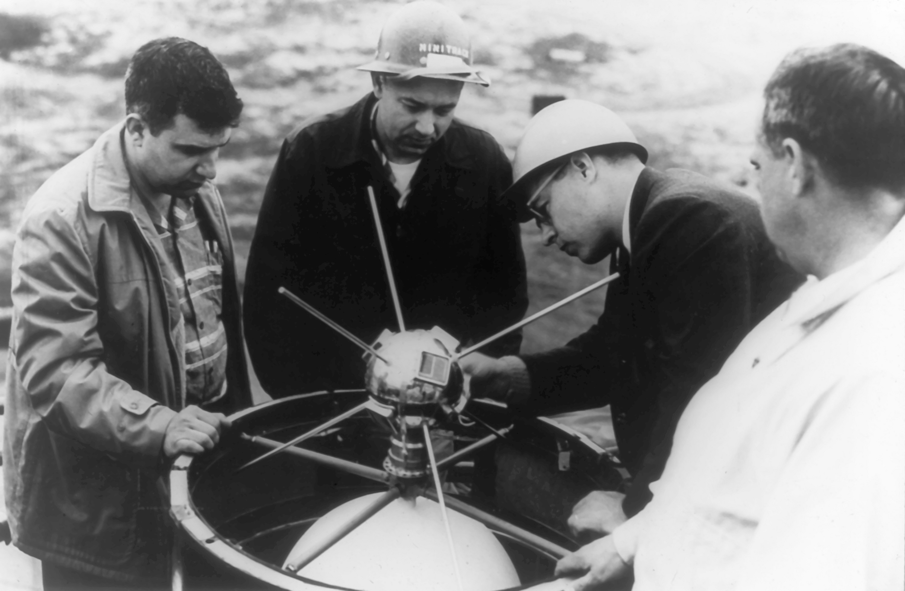
On March 17, 1958, the Vanguard I satellite was launched into Earth orbit. Vanguard I was the first solar-powered satellite, enabling it to continue transmitting for several years — other satellites of the time relied on batteries and only lasted weeks.
Vanguard I was the second artificial satellite successfully placed into Earth orbit by the United States and although communication with the satellite ceased in 1964, it remains the oldest man-made satellite in orbit today.

The U.S. Army launched the first U.S. satellite, Explorer I, on January 31, 1958. Like the Soviet satellites Sputnik I and II, Explorer I has fallen out of orbit.
With the success of the program, the Vanguard group, comprising approximately 200 scientists and engineers, became the core of NASA’s spaceflight activities at its establishment in 1958. The group remained housed at NRL until the new facilities at the Goddard Space Flight Center in Beltsville, Maryland, became available in September 1960.
Post-Vanguard Years
The exodus created by the newly formed space agency did not signal an end to NRL satellite and space-based research. Through the advocacy of NRL engineer Martin Votaw, who believed the Navy had an important role to play in space, a small contingent of remaining NRL rocket scientists and technicians regrouped to form the Satellite Techniques Branch, headed by Votaw.
The Satellite Techniques Branch staff concentrated on the engineering hardware — referred to as the satellite bus — and was responsible for the structure, power supply, command, telemetry, and coordination of a satellite, along with its interface with the launch vehicle. Additionally, the team managed special circuitry needed to support satellite payloads.
The group’s first post-Vanguard success was in June 1960 with the launch of the world’s first orbiting astronomical observatory to study the sun’s effects on the Earth. Piggybacked on Navy’s Transit IIA satellite, the first solar radiation satellite, SOLRAD-I, was equipped with both X-ray and Lyman-alpha sensors. Determining that radio fade-outs were caused by solar X-ray emissions, SOLRAD-I had an immediate scientific impact — verifying a theory held by NRL research physicist Dr. Herbert Friedman of the direct relationship between solar X-ray variability and the strength of the Earth's ionosphere.
Shrouded in secrecy for nearly 40 years, SOLRAD-I also shared the first U.S. Navy electronic intelligence (ELINT) instrumentation for Cold War reconnaissance. The project was originally called Tattletale, but it was renamed the Galactic Radiation and Background satellite system, or GRAB, to conceal its purpose from the Soviets.
The GRAB receivers clandestinely catalogued the waveforms and pulse-repetition frequencies of Soviet air defense radars. The telemetered data was recorded on magnetic tape and was couriered back to NRL, where analysts evaluated, duplicated, and forwarded it to the National Security Agency (NSA) at Fort George G. Meade in Maryland and the Strategic Air Command (SAC) at Offutt Air Force Base (Omaha, Nebraska) for analysis.
Between 1960 and 1973, successive SOLRAD satellites collected solar X-ray and ultraviolet data, with instrumentation and quality of data improving in each succeeding spacecraft in the SOLRAD series.
Building a Foundation for Space Exploration
Aside from measuring solar radiation and calibrating satellite tracking systems and a handful of classified deployments, NRL-made satellites have harvested massive amounts of basic data that became crucial for subsequent satellite design and for overall understanding of how the space environment can further the Navy’s mission and capabilities.
One of the more notable of these capabilities came from the launch of the TIMATION satellite in 1967. A vision of NRL research physicist Roger Easton, TIMATION (short for time navigation) proved that a system using a passive ranging technique combined with highly accurate [atomic] clocks could provide the basis for a new and revolutionary navigation system with three-dimensional coverage (longitude, latitude, and altitude) around the globe.
Through the development and launch of three additional experimental satellites — TIMATION II in 1969, the Navigation Technology Satellite (NTS-I) in 1974, and the first satellite to fly a cesium atomic frequency standard in a 12-hour orbit, NTS-2, in 1977 — Easton proved the practicality and unprecedented accuracy of satellite-based atomic clocks and laid the foundation for modern-day global positioning systems, better known as GPS.
Naval Center for Space Technology
By the mid-1980s, NRL was a key participant in the launch of nearly 80 satellites. In recognition of this sustained record of excellence, in 1986, the U.S. Navy formalized NRL's status as its lead laboratory in space technology by officially inaugurating the Naval Center for Space Technology (NCST) at NRL.
Leading the space program at NRL since 1964 and encompassing more than five decades of experience in the development, deployment. and operation of satellites critical to the nation's defense and intelligence-gathering capabilities, NCST was tasked to turn its attention toward deep-space exploration and NRL’s first lunar satellite.
Formally named the Deep Space Program Science Experiment, NCST’s first project — dubbed Clementine shortly thereafter due to its predestined, ”one-way” mission — launched on January 25, 1994. Extensively mapping the moon between February 26 and April 22 of that year, Clementine captured nearly 2 million digital images of the lunar surface.

When scientists reviewed the data, they made the major scientific discovery of possible ice within some of the moon’s craters. President Bill Clinton cited this accomplishment as one of the major national achievements in space. NASA later confirmed the discovery of ice in 2009 using its Lunar Reconnaissance Orbiter (LRO).
In the late 1990s and early into the following decade, NCST hosted Project STARshine (Student Tracked Atmospheric Research satellites), a mentoring program that provided students with insight and understanding into the satellite development process, orbital dynamics, and scientific methods.
Over the course of the program, students launched and tracked three small, optically reflective, spherical Starshine satellites to collect data on the density of the Earth's atmosphere. NRL scientists used this data to measure the effects of solar extreme ultraviolet radiation on satellite orbital decay.
In 2003, under the sponsorship of the National Polar-orbiting Operational Environmental Satellite System (NPOESS) Integrated Program Office (IPO), the NRL-developed WindSat satellite was launched on January 6 to provide important meteorological information on ocean surface wind speed and direction. Today, WindSat continues to deliver real-time, tactical information to naval surface units. WindSat’s continued measurements over the ocean are used operationally as input to numerical weather-prediction models of the U.S. Navy, the National Oceanic and Atmospheric Administration (NOAA), and the United Kingdom Meteorological Office.
Embarking on new, cost-effective, compact, quick-launch, space-based platforms, two NCST-designed and -built experimental nanosatellites, NRL’s 98th and 99th orbiting spacecraft, was launched on December 8, 2010.
Known as the CubeSat Experiment (QbX), satellites QbX1 and QbX2 were deployed by NRL to evaluate nanosatellites as a cost-effective platform for experimentation and technology development. The QbX vehicles, positioned in a low-Earth orbit and controlled using a novel, so-called space dart mode, remained in orbit for only 30 days before succumbing to the effects of atmospheric drag.
With the launch of NRL’s 100th man-made satellite to Earth orbit on September 27, 2011, TacSat-4 was designed to help define future options for launching one or more smaller satellites into low highly elliptical orbit (L-HEO) and to test advances in several technologies and satellite communication (SATCOM) techniques. In addition to demonstrating the potential benefits of a future, combined L-HEO-and-geosynchronous-orbit constellation, TacSat-4’s primary objectives were twofold. First, it would allow forward-deployed troops to communicate from obscured regions while on the move using existing hand-held radios and without the need to point an antenna toward a satellite. Second, it would demonstrate tactical mission planning of a satellite directly by deployed forces operators via the virtual mission operations center (VMOC) system over the Secure Internet Protocol Router Network (SIPRNet).
In the past decade, NRL has continued its commitment to providing expertise in the development and acquisition of space systems for naval missions.
In 2017, NRL launched CHEFsat (Cost-effective High E-Frequency Satellite), a 3U CubeSat to test and prepare consumer communications technology for use in space. In 2019, the launch of TEPCE (Tether Electrodynamic Propulsion Cubesat Experiment) to test a proof of concept of electrodynamic propulsion technology of tethered satellites.
Guiding the Future
The Naval Center for Space Technology Directorate remains the U.S. Navy's lead laboratory in space technology research and applications. Dedicated to preserving and enhancing a strong space technology base and providing expert assistance in the development and acquisition of space systems for naval missions, the activities of NCST extend from basic and applied research through advanced development in all areas of interest to the Navy’s space program.
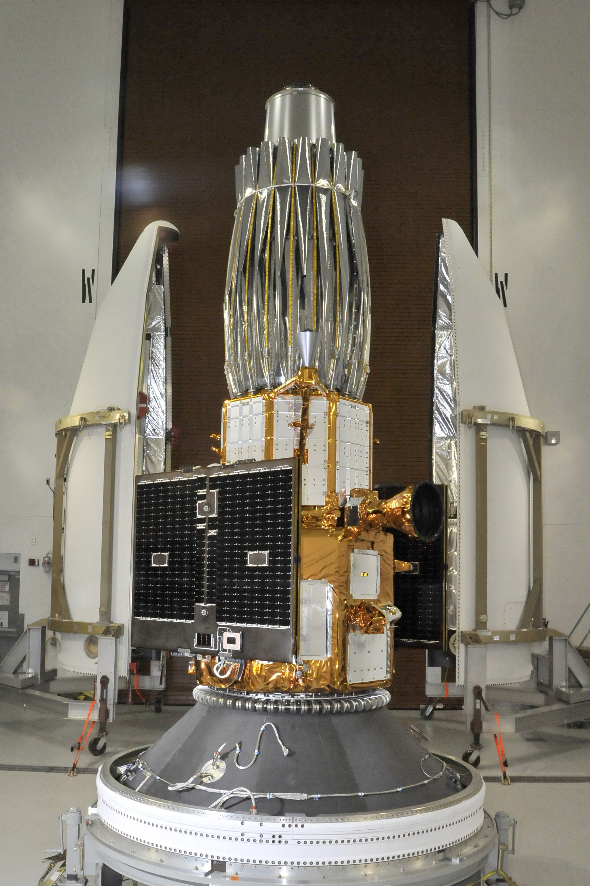
In 2024, NRL anticipates the launch of the Robotic Servicing of Geosynchronous Satellites (RSGS) vehicle, which is designed to inspect and service satellites in geosynchronous Earth orbit (GEO). The RSGS program is a public-private partnership between the Defense Advanced Research Projects Agency (DARPA) and SpaceLogistics — a wholly owned subsidiary of Northrop Grumman — with NRL developing the robotic servicing payload.
Once in orbit, the RSGS robotic servicing vehicle will inspect and service satellites in GEO, where hundreds of satellites provide communications, monitor weather, support national security missions, and other vital functions. The RSGS payload includes flight hardware components, robotic control algorithms, multiple highly customized electronics designs, and flight software running on five single-board computers. NRL also specified and procured two dexterous, seven-degree-of-freedom robotic arms, outfitting them with control electronics, cameras, lights, and a robotic tool changer.

Operating under the NCST Directorate are the Space Systems Development Department (SSDD), responsible for space and ground support systems research and development, and the Spacecraft Engineering Department (SED), functioning as the program manager for Navy space programs, providing systems engineering, technical direction, and in-house satellite development.
Continuing to innovate past, present and future naval space system programs, SED also owns and operates the Blossom Point Tracking Facility (BPTF) in southern Maryland. Commissioned in 1956, BPTF has a history steeped in NRL satellite tracking innovations, beginning with the Minitrack satellite system in 1956 and the launch of Vanguard I, the U.S. Navy’s first satellite, 65 years ago.
Today, BPTF is a 42-acre campus consisting of a satellite mission operations center, multiple antennas, and an existing infrastructure capable of providing space system command, control, and management for all customer classes in every orbit regime. The facility is in continuous operation 24 hours per day, 7 days per week, and at present supports numerous spacecraft in orbit. The foundation for this broad range of capabilities is the NRL-developed and government-owned Neptune® Common Ground Architecture (CGA) software system.
Neptune/CGA is government off-the-shelf (GOTS) software developed by NRL to provide a command-and-control software suite capable of spaceflight support services for automated testing and qualification of spaceflight articles; intelligent automation of on-orbit assets with minimal staffing or in “lights-out” operation; contact execution and predefined autonomous anomaly response and configuration; monitoring and reporting of the space and ground status and tracking, telemetry, operation, and control of satellites; receiving satellite data transmissions; and monitoring satellite health and data quality.
For more information about NRL's space exploration and research programs or other basic and applied research endeavors at NRL, please visit
www.nrl.navy.mil or contact NRL Corporate Communications at (202) 480-3746 or
nrlpao@nrl.navy.mil.
About the U.S. Naval Research Laboratory
NRL is a scientific and engineering command dedicated to research that drives innovative advances for the U.S. Navy and the U.S. Marine Corps from the seafloor to space and in the information domain. NRL is located in Washington, D.C., with major field sites in Stennis Space Center, Mississippi, Key West, Florida, and Monterey, California, and employs approximately 3,000 civilian scientists, engineers and support personnel.
For more information, contact NRL Corporate Communications at (202) 480-3746 or
nrlpao@nrl.navy.mil.